
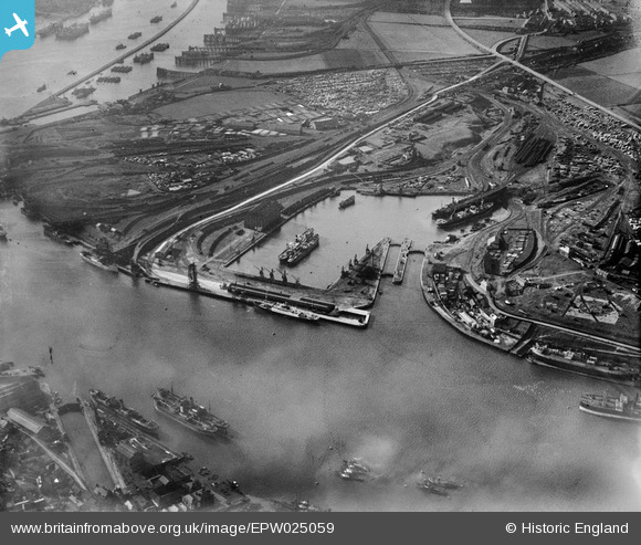
EPW025059 ENGLAND (1928). The Albert Edward Dock and the Timber Yards, Royal Quays, from the east, 1928
© Copyright OpenStreetMap contributors and licensed by the OpenStreetMap Foundation. 2026. Cartography is licensed as CC BY-SA.
Nearby Images (10)
EPW025059

EPW025063

EPW019845

EPW025066

EPW025070

EPW025058

EAW008935

EAW008941

EAW008942

EAW008937

Details
| Title | [EPW025059] The Albert Edward Dock and the Timber Yards, Royal Quays, from the east, 1928 |
| Reference | EPW025059 |
| Date | 14-October-1928 |
| Link | |
| Place name | ROYAL QUAYS |
| Parish | |
| District | |
| Country | ENGLAND |
| Easting / Northing | 435504, 566870 |
| Longitude / Latitude | -1.4449885038992, 54.995070789896 |
| National Grid Reference | NZ355669 |
Pins
Be the first to add a comment to this image!
User Comment Contributions
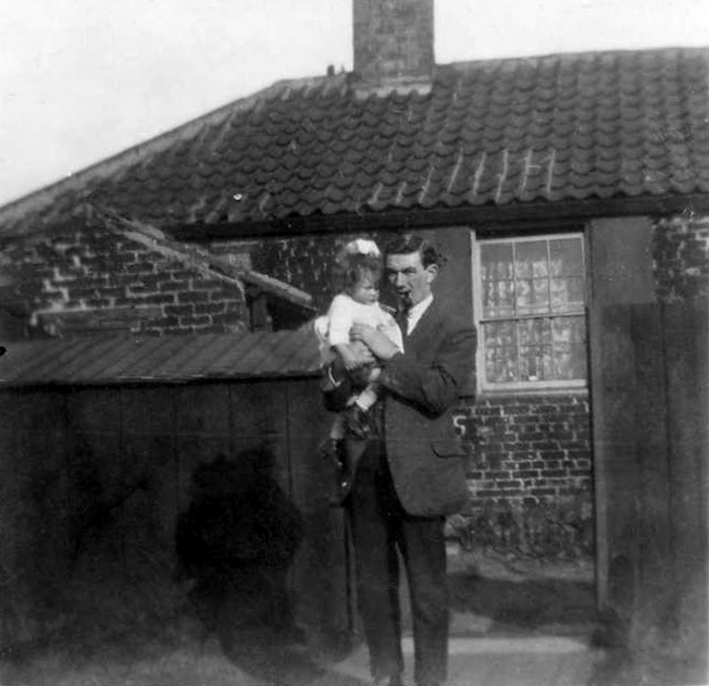
Interesting to look at these maps as I was born at Hope Cottage A.E.Dock in 1933. I think I've managed to see the cottage which had a bomb drop near it during W.W 2. It was so badly damaged it had to be demolished. The photo is of my Uncle Doug and my cousin about the time the maps were done B.Brown |

Brenda Brown |
Friday 19th of October 2012 10:49:58 PM |