
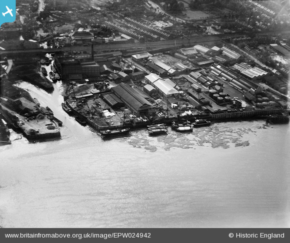
EPW024942 ENGLAND (1928). Thorley's Food Works, Wandsworth, 1928
© Copyright OpenStreetMap contributors and licensed by the OpenStreetMap Foundation. 2026. Cartography is licensed as CC BY-SA.
Nearby Images (3)
EPW024942

EPW046833

EPW011890

Details
| Title | [EPW024942] Thorley's Food Works, Wandsworth, 1928 |
| Reference | EPW024942 |
| Date | 6-October-1928 |
| Link | |
| Place name | WANDSWORTH |
| Parish | |
| District | |
| Country | ENGLAND |
| Easting / Northing | 525418, 175273 |
| Longitude / Latitude | -0.19441582759891, 51.462029065763 |
| National Grid Reference | TQ254753 |
Pins

london_lighterman |
Thursday 15th of January 2015 03:09:06 AM | |
|
london_lighterman |
Wednesday 14th of January 2015 09:12:24 PM | |
|
london_lighterman |
Wednesday 14th of January 2015 09:11:17 PM |
User Comment Contributions
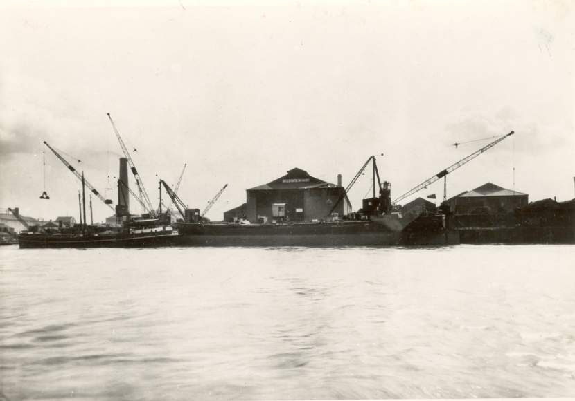
This is Allsop's Wharfe where the Wandle meets the Thames. I have contemporary photos showing the name "Allsop's Wharfe" on the large warehouse behind the 3 barges. James Allsop was my grandfather. |
Mr |
Tuesday 3rd of July 2012 07:19:33 PM |