
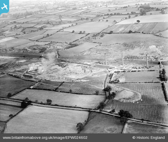
EPW024602 ENGLAND (1928). The Stoneware Limited Works and clay pits, Whateley, from the west, 1928
© Copyright OpenStreetMap contributors and licensed by the OpenStreetMap Foundation. 2026. Cartography is licensed as CC BY-SA.
Nearby Images (15)
EPW024602

EPW024610

EPW024598

EPW024597

EPW044463

EPW024611

EPW024607

EPW024600

EPW024595

EPW044461

EPW024609

EPW044460

EPW044462

EPW024596

EPW024608

Details
| Title | [EPW024602] The Stoneware Limited Works and clay pits, Whateley, from the west, 1928 |
| Reference | EPW024602 |
| Date | September-1928 |
| Link | |
| Place name | WHATELEY |
| Parish | KINGSBURY |
| District | |
| Country | ENGLAND |
| Easting / Northing | 421484, 299162 |
| Longitude / Latitude | -1.6828394519062, 52.589478318905 |
| National Grid Reference | SP215992 |
Pins

johnny {strip} |
Sunday 23rd of April 2023 03:43:27 PM | |
|
johnny {strip} |
Sunday 23rd of April 2023 03:42:02 PM | |
|
johnny {strip} |
Sunday 23rd of April 2023 03:40:44 PM |