
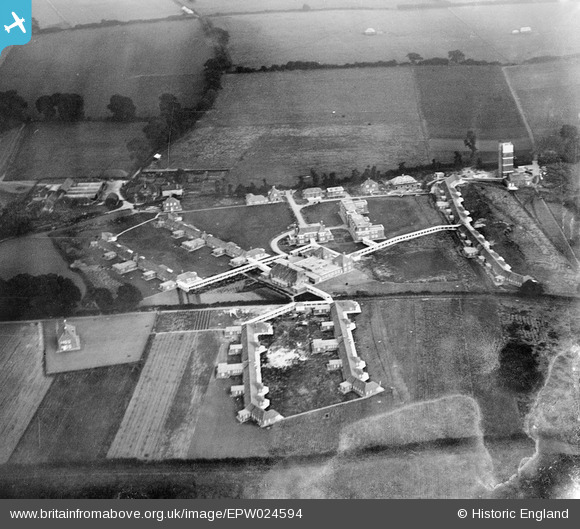
EPW024594 ENGLAND (1928). The Surrey County Sanatorium, Tuesley, 1928
© Copyright OpenStreetMap contributors and licensed by the OpenStreetMap Foundation. 2026. Cartography is licensed as CC BY-SA.
Nearby Images (15)
EPW024594

EPW023435

EPW024590

EPW024592

EPW024589

EPW024588

EPW024922

EPW023437

EPW024593

EPW023440

EPW024923

EPW024921

EPW024587

EPW024930

EPW023436

Details
| Title | [EPW024594] The Surrey County Sanatorium, Tuesley, 1928 |
| Reference | EPW024594 |
| Date | September-1928 |
| Link | |
| Place name | TUESLEY |
| Parish | BUSBRIDGE |
| District | |
| Country | ENGLAND |
| Easting / Northing | 496173, 141821 |
| Longitude / Latitude | -0.62431643511623, 51.167016225843 |
| National Grid Reference | SU962418 |
Pins
Be the first to add a comment to this image!