
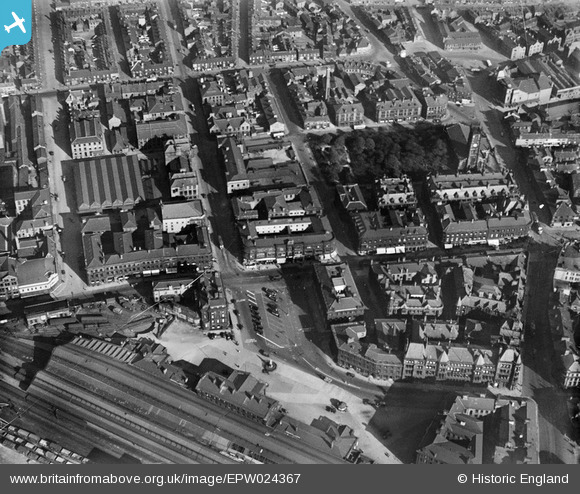
EPW024367 ENGLAND (1928). St George's Square and environs, Huddersfield, 1928
© Copyright OpenStreetMap contributors and licensed by the OpenStreetMap Foundation. 2026. Cartography is licensed as CC BY-SA.
Nearby Images (7)
EPW024367

EPW024369

EPW016137

EPW045316

EPW024366

EPW045321

EPW045315

Details
| Title | [EPW024367] St George's Square and environs, Huddersfield, 1928 |
| Reference | EPW024367 |
| Date | September-1928 |
| Link | |
| Place name | HUDDERSFIELD |
| Parish | |
| District | |
| Country | ENGLAND |
| Easting / Northing | 414473, 416885 |
| Longitude / Latitude | -1.7810266528115, 53.648036963021 |
| National Grid Reference | SE145169 |
