
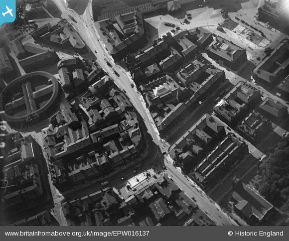
EPW016137 ENGLAND (1926). Westgate and environs, Huddersfield, 1926
© Copyright OpenStreetMap contributors and licensed by the OpenStreetMap Foundation. 2026. Cartography is licensed as CC BY-SA.
Nearby Images (9)
EPW016137

EPW045316

EPW024369

EPW024366

EPW024367

EPW024368

EPW045321

EPW045315

EPW016130

Details
| Title | [EPW016137] Westgate and environs, Huddersfield, 1926 |
| Reference | EPW016137 |
| Date | 2-July-1926 |
| Link | |
| Place name | HUDDERSFIELD |
| Parish | |
| District | |
| Country | ENGLAND |
| Easting / Northing | 414434, 416744 |
| Longitude / Latitude | -1.7816232580573, 53.646770567104 |
| National Grid Reference | SE144167 |
Pins

john h |
Wednesday 8th of July 2015 07:22:00 PM | |

Blayeman |
Friday 19th of October 2012 05:01:53 PM | |
Loin Chambers is really Lion Chambers |
Tyke Accountant |
Wednesday 12th of November 2014 11:05:10 AM |
|
Blayeman |
Friday 19th of October 2012 05:01:10 PM | |
The building currently marked as Half Moon House is not correct. Standard House is to the left and is a "V-shaped" building, formerly the offices of Standard Fireworks and containing many small businesses on the upper floors. |
Tyke Accountant |
Wednesday 12th of November 2014 11:02:25 AM |
|
Blayeman |
Friday 19th of October 2012 05:00:10 PM | |
|
Blayeman |
Friday 19th of October 2012 04:59:24 PM | |
|
Blayeman |
Friday 19th of October 2012 04:58:41 PM | |
|
Blayeman |
Friday 19th of October 2012 04:57:59 PM | |
|
Blayeman |
Friday 19th of October 2012 04:57:12 PM | |
|
Blayeman |
Friday 19th of October 2012 04:55:52 PM | |
The Huddersfield Piece Hall is better known as Huddersfield Cloth Hall, hence the name of the street leading towards it. This was demolished in the 1930's to make way for the Ritz (ABC) cinema, which in turn was replaced by the current Sainsbury's supermarket. |
Tyke Accountant |
Wednesday 12th of November 2014 11:11:36 AM |