
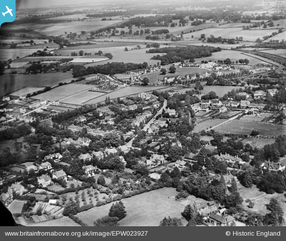
EPW023927 ENGLAND (1928). Clarence Road and environs, Harpenden, 1928
© Copyright OpenStreetMap contributors and licensed by the OpenStreetMap Foundation. 2026. Cartography is licensed as CC BY-SA.
Nearby Images (5)
EPW023927

EPW007533

EAW047652

EAW047651

EAW047650

Details
| Title | [EPW023927] Clarence Road and environs, Harpenden, 1928 |
| Reference | EPW023927 |
| Date | September-1928 |
| Link | |
| Place name | HARPENDEN |
| Parish | HARPENDEN |
| District | |
| Country | ENGLAND |
| Easting / Northing | 513006, 215079 |
| Longitude / Latitude | -0.36016386859242, 51.822445310009 |
| National Grid Reference | TL130151 |
Pins

toshiba |
Tuesday 23rd of February 2021 06:42:46 PM | |
|
DavidR |
Tuesday 5th of May 2020 01:42:11 PM | |
|
billb |
Wednesday 1st of August 2012 08:44:03 PM | |
|
billb |
Wednesday 1st of August 2012 08:43:18 PM | |
Commonly known as 'The Nicky Line' |
billb |
Wednesday 1st of August 2012 08:52:14 PM |
|
billb |
Wednesday 1st of August 2012 08:40:20 PM |