
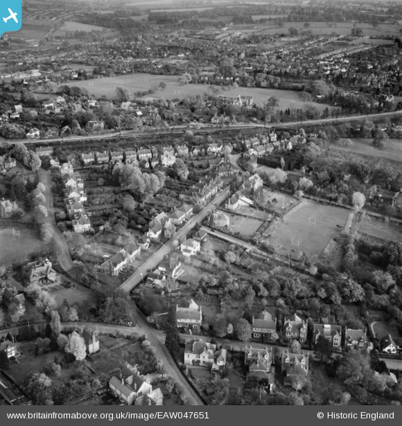
EAW047651 ENGLAND (1952). Wordsworth Road, Hardenwick School Playing Field and the surrounding area, Harpenden, 1952
© Copyright OpenStreetMap contributors and licensed by the OpenStreetMap Foundation. 2026. Cartography is licensed as CC BY-SA.
Nearby Images (8)
EAW047651

EAW047649

EPW007533

EAW047643

EAW047650

EAW047652

EPW023927

EAW047653

Details
| Title | [EAW047651] Wordsworth Road, Hardenwick School Playing Field and the surrounding area, Harpenden, 1952 |
| Reference | EAW047651 |
| Date | 27-October-1952 |
| Link | |
| Place name | HARPENDEN |
| Parish | HARPENDEN |
| District | |
| Country | ENGLAND |
| Easting / Northing | 513234, 215037 |
| Longitude / Latitude | -0.35687055244875, 51.822021634609 |
| National Grid Reference | TL132150 |
Pins
Be the first to add a comment to this image!