
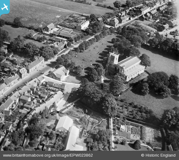
EPW023862 ENGLAND (1928). St Peter's Church and environs, Dunstable, 1928
© Copyright OpenStreetMap contributors and licensed by the OpenStreetMap Foundation. 2026. Cartography is licensed as CC BY-SA.
Nearby Images (9)
EPW023862

EPW023861

EPW023863

EPW023860

EPW056929

EPW023859

EPW056927

EPW014815

EPW056928

Details
| Title | [EPW023862] St Peter's Church and environs, Dunstable, 1928 |
| Reference | EPW023862 |
| Date | September-1928 |
| Link | |
| Place name | DUNSTABLE |
| Parish | DUNSTABLE |
| District | |
| Country | ENGLAND |
| Easting / Northing | 502094, 221881 |
| Longitude / Latitude | -0.51643852306684, 51.88568895183 |
| National Grid Reference | TL021219 |
Pins

melgibbs |
Saturday 11th of January 2014 06:55:16 PM |