
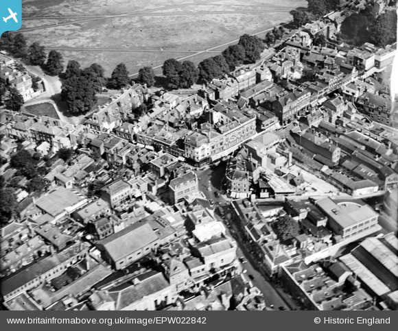
EPW022842 ENGLAND (1928). The junction of King Street and George Street, Richmond, 1928
© Copyright OpenStreetMap contributors and licensed by the OpenStreetMap Foundation. 2026. Cartography is licensed as CC BY-SA.
Nearby Images (17)
EPW022842

EPW031991

EPW031989

EPW031992

EPW056173

EPW031990

EAW015163

EPW031988

EPW031987

EAW015162

EAW015164

EAW015165

EAW014149

EAW014150

EAW014151

EAW008242

EAW042758

Details
| Title | [EPW022842] The junction of King Street and George Street, Richmond, 1928 |
| Reference | EPW022842 |
| Date | August-1928 |
| Link | |
| Place name | RICHMOND |
| Parish | |
| District | |
| Country | ENGLAND |
| Easting / Northing | 517757, 174791 |
| Longitude / Latitude | -0.30481461918052, 51.459342635184 |
| National Grid Reference | TQ178748 |
Pins

Martin Devlin |
Sunday 12th of April 2020 12:47:45 PM | |
|
HW64 |
Saturday 29th of December 2012 01:30:57 PM | |
|
HW64 |
Saturday 29th of December 2012 01:30:22 PM |