
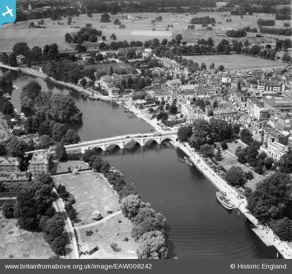
EAW008242 ENGLAND (1947). Richmond Bridge and environs, Richmond, 1947
© Copyright OpenStreetMap contributors and licensed by the OpenStreetMap Foundation. 2026. Cartography is licensed as CC BY-SA.
Nearby Images (25)
EAW008242

EPW022837

EPW056173

EPW044552

EAW042759

EPW022844

EAW042758

EAW026799

EPW022838

EPW008871

EPW001695

EPW001693

EAW026798

EAW042757

EPW031987

EPW031989

EPW031992

EPW031991

EPW001694

EPW031988

EPW022842

EPW031990

EAW015165

EAW015163

EAW015162

Details
| Title | [EAW008242] Richmond Bridge and environs, Richmond, 1947 |
| Reference | EAW008242 |
| Date | 16-July-1947 |
| Link | |
| Place name | RICHMOND |
| Parish | |
| District | |
| Country | ENGLAND |
| Easting / Northing | 517720, 174556 |
| Longitude / Latitude | -0.30542525087781, 51.457238003609 |
| National Grid Reference | TQ177746 |
Pins

MB |
Friday 15th of November 2013 10:33:24 AM |