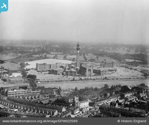
EPW022589 ENGLAND (1928). The University of Birmingham, Edgbaston, from the south-west, 1928
© Copyright OpenStreetMap contributors and licensed by the OpenStreetMap Foundation. 2026. Cartography is licensed as CC BY-SA.
Nearby Images (9)
EPW022589

EPW022591

EAW016387

EAW016388

EAW016386

EPW001119

EAW016395

EAW016389

EAW016390

Details
| Title | [EPW022589] The University of Birmingham, Edgbaston, from the south-west, 1928 |
| Reference | EPW022589 |
| Date | 7-August-1928 |
| Link | |
| Place name | EDGBASTON |
| Parish | |
| District | |
| Country | ENGLAND |
| Easting / Northing | 404693, 283269 |
| Longitude / Latitude | -1.9309427881958, 52.446989654812 |
| National Grid Reference | SP047833 |
Pins

Fred |
Friday 11th of October 2024 01:30:26 PM | |
|
JohnL |
Wednesday 9th of September 2020 04:07:48 PM | |

Brasspot |
Wednesday 27th of June 2012 09:16:10 PM | |
|
Brasspot |
Wednesday 27th of June 2012 09:14:35 PM |