
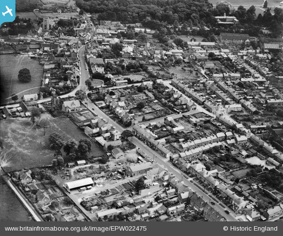
EPW022475 ENGLAND (1928). Western Road and the town centre, Tring, 1928
© Copyright OpenStreetMap contributors and licensed by the OpenStreetMap Foundation. 2026. Cartography is licensed as CC BY-SA.
Nearby Images (4)
EPW022475

EPW001243

EPW022477

EPW022476

Details
| Title | [EPW022475] Western Road and the town centre, Tring, 1928 |
| Reference | EPW022475 |
| Date | 9-August-1928 |
| Link | |
| Place name | TRING |
| Parish | TRING |
| District | |
| Country | ENGLAND |
| Easting / Northing | 492095, 211233 |
| Longitude / Latitude | -0.664527658423, 51.791710213115 |
| National Grid Reference | SP921112 |
Pins

IR |
Wednesday 12th of February 2014 03:48:48 PM |