
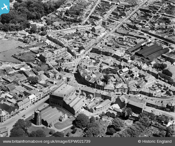
EPW021739 ENGLAND (1928). Commercial Street and the town centre, Camborne, 1928
© Copyright OpenStreetMap contributors and licensed by the OpenStreetMap Foundation. 2026. Cartography is licensed as CC BY-SA.
Nearby Images (9)
EPW021739

EPW021737

EPW059670

EPW009887

EPW021736

EAW033646

EAW033645

EPW021738

EPW021735

Details
| Title | [EPW021739] Commercial Street and the town centre, Camborne, 1928 |
| Reference | EPW021739 |
| Date | 24-June-1928 |
| Link | |
| Place name | CAMBORNE |
| Parish | CAMBORNE |
| District | |
| Country | ENGLAND |
| Easting / Northing | 164648, 40066 |
| Longitude / Latitude | -5.2992100522863, 50.213092858099 |
| National Grid Reference | SW646401 |
