
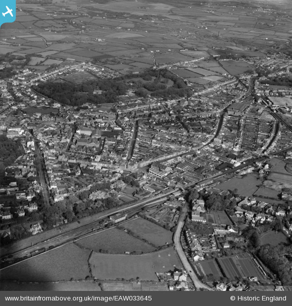
EAW033645 ENGLAND (1950). The town, Camborne, 1950
© Copyright OpenStreetMap contributors and licensed by the OpenStreetMap Foundation. 2026. Cartography is licensed as CC BY-SA.
Nearby Images (21)
EAW033645

EPW039770

EPW021738

EPW021735

EAW027858

EAW027859

EAW027857

EPW009888

EAW027860

EPW021736

EPW009886

EPW009934

EPW039768

EPW009887

EPW009933

EPW059670

EPW009889

EPW021737

EPW059671

EPW021739

EAW033646

Details
| Title | [EAW033645] The town, Camborne, 1950 |
| Reference | EAW033645 |
| Date | 12-October-1950 |
| Link | |
| Place name | CAMBORNE |
| Parish | CAMBORNE |
| District | |
| Country | ENGLAND |
| Easting / Northing | 164857, 39936 |
| Longitude / Latitude | -5.2962048862658, 50.212008607042 |
| National Grid Reference | SW649399 |
Pins
Be the first to add a comment to this image!