
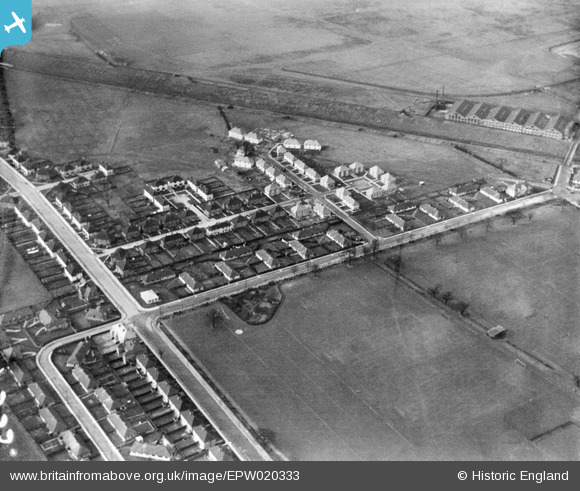
EPW020333 ENGLAND (1928). Norman Way and Public Playing Fields, Acton, 1928
© Copyright OpenStreetMap contributors and licensed by the OpenStreetMap Foundation. 2026. Cartography is licensed as CC BY-SA.
Nearby Images (17)
EPW020333

EPW020331

EPW020331
EPW020337

EPW020337
EPW020334

EPW020332

EPW020335

EPW020336

EPW020338

EPW021148

EPW020857

EPW021151

EPW020880

EPW021153

EPW020881

EPW020878

Details
| Title | [EPW020333] Norman Way and Public Playing Fields, Acton, 1928 |
| Reference | EPW020333 |
| Date | February-1928 |
| Link | |
| Place name | ACTON |
| Parish | |
| District | |
| Country | ENGLAND |
| Easting / Northing | 519884, 181542 |
| Longitude / Latitude | -0.27191676117424, 51.519576998278 |
| National Grid Reference | TQ199815 |


