
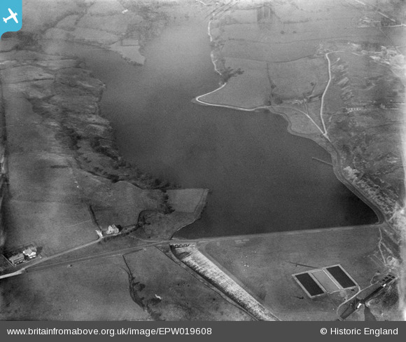
EPW019608 ENGLAND (1927). The Wayoh Reservoir, Edgworth, 1927
© Copyright OpenStreetMap contributors and licensed by the OpenStreetMap Foundation. 2026. Cartography is licensed as CC BY-SA.
Nearby Images (8)
EPW019608

EPW019609

EPW019610

EPW019364

EPW019363

EPW019611

EAW002681
 and Edgworth Quarry, Edgworth, 1946")
EAW002680
, Edgworth, 1946")
Details
| Title | [EPW019608] The Wayoh Reservoir, Edgworth, 1927 |
| Reference | EPW019608 |
| Date | 9-October-1927 |
| Link | |
| Place name | EDGWORTH |
| Parish | NORTH TURTON |
| District | |
| Country | ENGLAND |
| Easting / Northing | 373471, 416503 |
| Longitude / Latitude | -2.401341601647, 53.644130645428 |
| National Grid Reference | SD735165 |
Pins
Be the first to add a comment to this image!