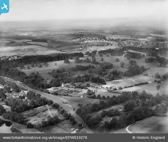
EPW019278 ENGLAND (1927). St Augustine's Priory and environs, Rickmansworth, from the south-east, 1927
    © Copyright OpenStreetMap contributors and licensed by the OpenStreetMap Foundation. 2025. Cartography is licensed as CC BY-SA.
  
Nearby Images (5)
Details
| Title | [EPW019278] St Augustine's Priory and environs, Rickmansworth, from the south-east, 1927 | 
| Reference | EPW019278 | 
| Date | 12-October-1927 | 
| Link | |
| Place name | RICKMANSWORTH | 
| Parish | |
| District | |
| Country | ENGLAND | 
| Easting / Northing | 506446, 194776 | 
| Longitude / Latitude | -0.46152819484714, 51.641232305065 | 
| National Grid Reference | TQ064948 | 
 
             
  ![[EPW019278] St Augustine's Priory and environs, Rickmansworth, from the south-east, 1927](http://britainfromabove.org.uk/sites/all/libraries/aerofilms-images/public/100x100/EPW/019/EPW019278.jpg) 
  
                                          ![[EPW019279] St Augustine's Priory and environs, Rickmansworth, from the south-east, 1927](http://britainfromabove.org.uk/sites/all/libraries/aerofilms-images/public/100x100/EPW/019/EPW019279.jpg) 
 ![[EPW019295] Lake at Wharf Lane and Rickmansworth Park, Rickmansworth, 1927](http://britainfromabove.org.uk/sites/all/libraries/aerofilms-images/public/100x100/EPW/019/EPW019295.jpg) 
 ![[EPW019294] Rickmansworth Park, Rickmansworth, from the south-east, 1927](http://britainfromabove.org.uk/sites/all/libraries/aerofilms-images/public/100x100/EPW/019/EPW019294.jpg) 
 ![[EPW037387] The town, Rickmansworth, from the north-east, 1932](http://britainfromabove.org.uk/sites/all/libraries/aerofilms-images/public/100x100/EPW/037/EPW037387.jpg) 
  Salter's Brewery
 Salter's Brewery