
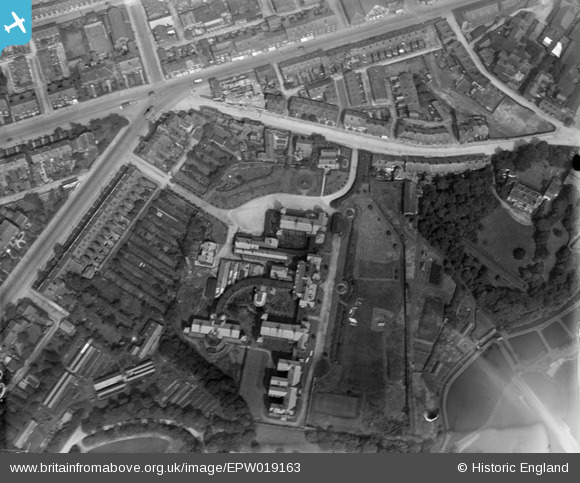
EPW019163 ENGLAND (1927). The Bolton Infirmary, Bolton, 1927
© Copyright OpenStreetMap contributors and licensed by the OpenStreetMap Foundation. 2026. Cartography is licensed as CC BY-SA.
Nearby Images (14)
EPW019163

EPW019162

EPW019165

EPW019169

EPW019164

EPW019167

EPW019166

EPW019168

EAW047049

EAW047046

EAW047044

EAW047047
 Ltd Minerva Saw Mills, Bolton, 1952. This image was marked by Aerofilms Ltd for photo editing.")
EAW047045
 Ltd Minerva Saw Mills, Bolton, 1952. This image was marked by Aerofilms Ltd for photo editing.")
EAW047048
 Ltd Minerva Saw Mills, Bolton, 1952. This image was marked by Aerofilms Ltd for photo editing.")
Details
| Title | [EPW019163] The Bolton Infirmary, Bolton, 1927 |
| Reference | EPW019163 |
| Date | August-1927 |
| Link | |
| Place name | BOLTON |
| Parish | |
| District | |
| Country | ENGLAND |
| Easting / Northing | 370961, 409485 |
| Longitude / Latitude | -2.4386583848336, 53.580912342338 |
| National Grid Reference | SD710095 |
Pins
Be the first to add a comment to this image!