
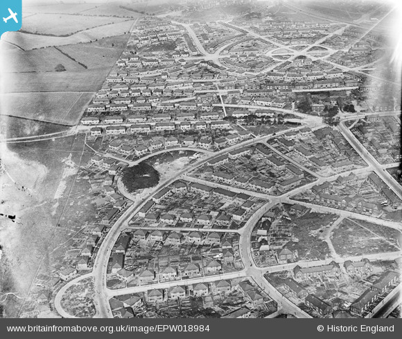
EPW018984 ENGLAND (1927). The Manor Estate, Sheffield, 1927
© Copyright OpenStreetMap contributors and licensed by the OpenStreetMap Foundation. 2026. Cartography is licensed as CC BY-SA.
Nearby Images (7)
EPW018984

EPW018979

EPW018980

EPW018981

EPW018982

EPW018985

EPW018983

Details
| Title | [EPW018984] The Manor Estate, Sheffield, 1927 |
| Reference | EPW018984 |
| Date | 25-July-1927 |
| Link | |
| Place name | SHEFFIELD |
| Parish | |
| District | |
| Country | ENGLAND |
| Easting / Northing | 438147, 385860 |
| Longitude / Latitude | -1.4266341446532, 53.367962581868 |
| National Grid Reference | SK381859 |
Pins
Be the first to add a comment to this image!