
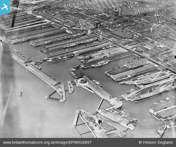
EPW018897 ENGLAND (1927). Canada Basin and docks to the north, Bootle, 1927
© Copyright OpenStreetMap contributors and licensed by the OpenStreetMap Foundation. 2026. Cartography is licensed as CC BY-SA.
Nearby Images (3)
EPW018897

EAW048048

EAW048050

Details
| Title | [EPW018897] Canada Basin and docks to the north, Bootle, 1927 |
| Reference | EPW018897 |
| Date | 17-July-1927 |
| Link | |
| Place name | BOOTLE |
| Parish | |
| District | |
| Country | ENGLAND |
| Easting / Northing | 333198, 394497 |
| Longitude / Latitude | -3.0058353659794, 53.442748468417 |
| National Grid Reference | SJ332945 |
Pins
Be the first to add a comment to this image!