
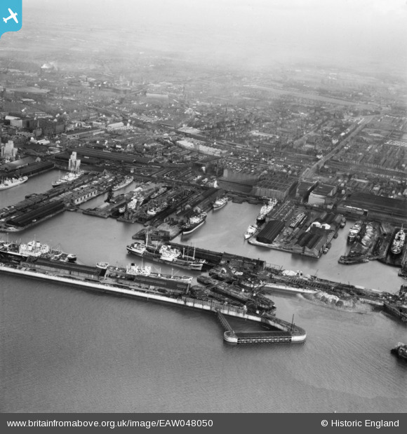
EAW048050 ENGLAND (1952). Langton Dock and Brocklebank Dock, Bootle, from the south-west, 1952
© Copyright OpenStreetMap contributors and licensed by the OpenStreetMap Foundation. 2026. Cartography is licensed as CC BY-SA.
Nearby Images (5)
EAW048050

EAW048048

EAW001707

EPW018900

EPW018897

Details
| Title | [EAW048050] Langton Dock and Brocklebank Dock, Bootle, from the south-west, 1952 |
| Reference | EAW048050 |
| Date | 12-December-1952 |
| Link | |
| Place name | BOOTLE |
| Parish | |
| District | |
| Country | ENGLAND |
| Easting / Northing | 332987, 394282 |
| Longitude / Latitude | -3.0089660577264, 53.440789226946 |
| National Grid Reference | SJ330943 |
Pins

redmist |
Friday 12th of February 2021 08:00:33 PM |