
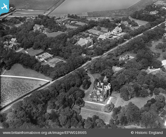
EPW018665 ENGLAND (1927). Christ Church and environs, Markland Hill, 1927
© Copyright OpenStreetMap contributors and licensed by the OpenStreetMap Foundation. 2026. Cartography is licensed as CC BY-SA.
Nearby Images (3)
EPW018665

EPW018666

EAW002676
, Markland Hill, 1946")
Details
| Title | [EPW018665] Christ Church and environs, Markland Hill, 1927 |
| Reference | EPW018665 |
| Date | 2-July-1927 |
| Link | |
| Place name | MARKLAND HILL |
| Parish | |
| District | |
| Country | ENGLAND |
| Easting / Northing | 368505, 409376 |
| Longitude / Latitude | -2.4757459671618, 53.579790771411 |
| National Grid Reference | SD685094 |
Pins

JMB |
Friday 29th of June 2012 08:20:54 PM | |
|
JMB |
Friday 29th of June 2012 08:20:33 PM | |
|
JMB |
Friday 29th of June 2012 08:19:02 PM | |
|
JMB |
Friday 29th of June 2012 08:18:28 PM | |
|
JMB |
Friday 29th of June 2012 08:17:54 PM | |
|
JMB |
Friday 29th of June 2012 08:15:45 PM | |
|
JMB |
Friday 29th of June 2012 08:15:10 PM | |
|
JMB |
Friday 29th of June 2012 08:13:46 PM |