
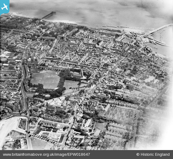
EPW018647 ENGLAND (1927). St George's Church and the town, Ramsgate, 1927
© Copyright OpenStreetMap contributors and licensed by the OpenStreetMap Foundation. 2026. Cartography is licensed as CC BY-SA.
Nearby Images (4)
EPW018647

EPW018645

EPW000603

EPW052884

Details
| Title | [EPW018647] St George's Church and the town, Ramsgate, 1927 |
| Reference | EPW018647 |
| Date | 22-June-1927 |
| Link | |
| Place name | RAMSGATE |
| Parish | RAMSGATE |
| District | |
| Country | ENGLAND |
| Easting / Northing | 638164, 165184 |
| Longitude / Latitude | 1.4195900704779, 51.335274230236 |
| National Grid Reference | TR382652 |
Pins

Alan McFaden |
Sunday 13th of July 2014 05:33:03 PM | |
|
Alan McFaden |
Sunday 13th of July 2014 05:31:47 PM | |
|
Alan McFaden |
Sunday 13th of July 2014 05:30:58 PM | |
|
Alan McFaden |
Sunday 13th of July 2014 05:30:27 PM | |
|
Alan McFaden |
Sunday 13th of July 2014 05:29:53 PM | |

Survey of London historian |
Thursday 2nd of August 2012 11:32:43 PM | |
|
EZTD |
Monday 2nd of July 2012 09:55:21 PM | |
|
EZTD |
Monday 2nd of July 2012 09:54:42 PM | |
|
EZTD |
Monday 2nd of July 2012 09:54:09 PM | |
|
EZTD |
Monday 2nd of July 2012 09:53:37 PM | |
|
EZTD |
Monday 2nd of July 2012 09:52:38 PM |


