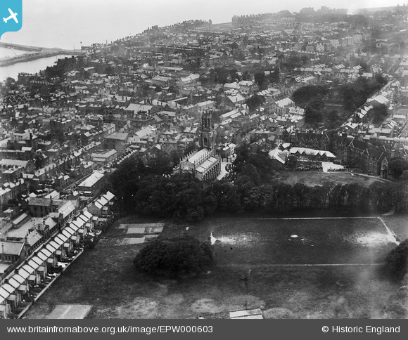
EPW000603 ENGLAND (1920). St George's Church, Ramsgate, from the north-east, 1920
    © Copyright OpenStreetMap contributors and licensed by the OpenStreetMap Foundation. 2025. Cartography is licensed as CC BY-SA.
  
Details
| Title | [EPW000603] St George's Church, Ramsgate, from the north-east, 1920 | 
| Reference | EPW000603 | 
| Date | May-1920 | 
| Link | |
| Place name | RAMSGATE | 
| Parish | RAMSGATE | 
| District | |
| Country | ENGLAND | 
| Easting / Northing | 638192, 165279 | 
| Longitude / Latitude | 1.4200548578998, 51.336115291488 | 
| National Grid Reference | TR382653 | 
Pins
|  Tomson & Wotton Brewery, Queen Street, Ramsgate, Kent.
Founded 1634. Purchased by Whitbread & Co. Ltd in 1968 and was closed October 1968 and brewery demolished. Waitrose supermarket and carpark now stands on the site. |   Stu Giles | Tuesday 1st of November 2022 08:19:18 PM | 
|   Alan McFaden | Friday 11th of July 2014 05:34:40 PM | |
|  Chatham House Grammar School |   DavidJCarr | Wednesday 15th of August 2012 12:47:30 PM | 
 
             
  ![[EPW000603] St George's Church, Ramsgate, from the north-east, 1920](http://britainfromabove.org.uk/sites/all/libraries/aerofilms-images/public/100x100/EPW/000/EPW000603.jpg) 
  
                                          ![[EPW018647] St George's Church and the town, Ramsgate, 1927](http://britainfromabove.org.uk/sites/all/libraries/aerofilms-images/public/100x100/EPW/018/EPW018647.jpg) 
 ![[EPW018645] St George's Church and the town, Ramsgate, 1927](http://britainfromabove.org.uk/sites/all/libraries/aerofilms-images/public/100x100/EPW/018/EPW018645.jpg) 
 ![[EPW052884] The town, Ramsgate, 1937. This image has been produced from a print.](http://britainfromabove.org.uk/sites/all/libraries/aerofilms-images/public/100x100/EPW/052/EPW052884.jpg) 
 