
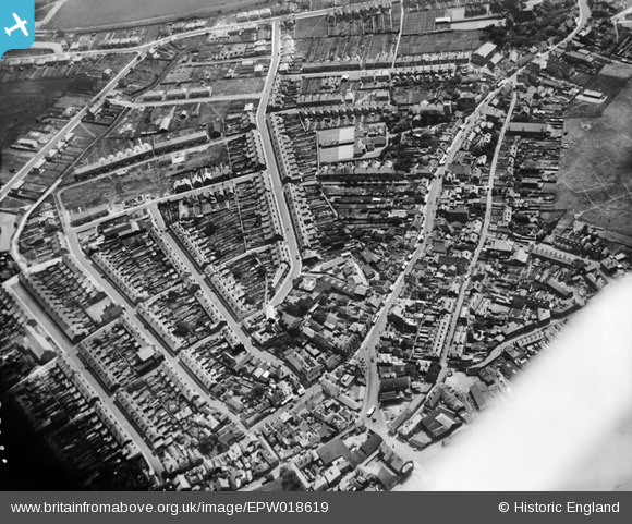
EPW018619 ENGLAND (1927). The area around the Whitstable and Seasalter School and Regent Street, Whitstable, 1927
© Copyright OpenStreetMap contributors and licensed by the OpenStreetMap Foundation. 2026. Cartography is licensed as CC BY-SA.
Nearby Images (6)
EPW018619

EPW018617

EPW018620

EPW054082

EPW054078

EPW000651

Details
| Title | [EPW018619] The area around the Whitstable and Seasalter School and Regent Street, Whitstable, 1927 |
| Reference | EPW018619 |
| Date | 22-June-1927 |
| Link | |
| Place name | WHITSTABLE |
| Parish | |
| District | |
| Country | ENGLAND |
| Easting / Northing | 610727, 166612 |
| Longitude / Latitude | 1.0271200619341, 51.358930016599 |
| National Grid Reference | TR107666 |
Pins

Sparky |
Saturday 31st of October 2020 05:28:01 PM | |
|
Sparky |
Saturday 31st of October 2020 05:27:29 PM | |
|
Sparky |
Saturday 31st of October 2020 05:26:40 PM | |
|
Sparky |
Saturday 31st of October 2020 05:25:56 PM | |
|
Sparky |
Saturday 31st of October 2020 05:25:19 PM | |

PaulCT5 |
Monday 12th of October 2015 08:07:24 PM | |
|
janetken1 |
Thursday 20th of June 2013 03:22:17 PM |