
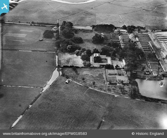
EPW018583 ENGLAND (1927). Stonar House, Sandwich, 1927
© Copyright OpenStreetMap contributors and licensed by the OpenStreetMap Foundation. 2026. Cartography is licensed as CC BY-SA.
Nearby Images (10)
EPW018583

EPW018585

EPW018582

EPW018590

EPW018587

EPW018584

EPW018581

EPW018588

EPW018589

EPW018586

Details
| Title | [EPW018583] Stonar House, Sandwich, 1927 |
| Reference | EPW018583 |
| Date | 22-June-1927 |
| Link | |
| Place name | SANDWICH |
| Parish | SANDWICH |
| District | |
| Country | ENGLAND |
| Easting / Northing | 633581, 158584 |
| Longitude / Latitude | 1.3495877611015, 51.277924462744 |
| National Grid Reference | TR336586 |
Pins

The Laird |
Sunday 29th of June 2014 05:18:23 PM |