
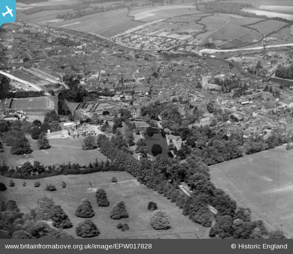
EPW017828 ENGLAND (1927). The town centre including Wycombe Abbey, High Wycombe, from the south-east, 1927
© Copyright OpenStreetMap contributors and licensed by the OpenStreetMap Foundation. 2026. Cartography is licensed as CC BY-SA.
Nearby Images (6)
EPW017828

EPW038415

EPW038416

EAW024279

EAW024278

EPW017821

Details
| Title | [EPW017828] The town centre including Wycombe Abbey, High Wycombe, from the south-east, 1927 |
| Reference | EPW017828 |
| Date | April-1927 |
| Link | |
| Place name | HIGH WYCOMBE |
| Parish | |
| District | |
| Country | ENGLAND |
| Easting / Northing | 486815, 192576 |
| Longitude / Latitude | -0.74572063755539, 51.624827944837 |
| National Grid Reference | SU868926 |
Pins

kevin_s |
Thursday 5th of July 2012 11:21:50 PM |
User Comment Contributions
Wycombe Wanderers Football Club, Loakes Park 1927. |
kevin_s |
Thursday 5th of July 2012 11:22:47 PM |