
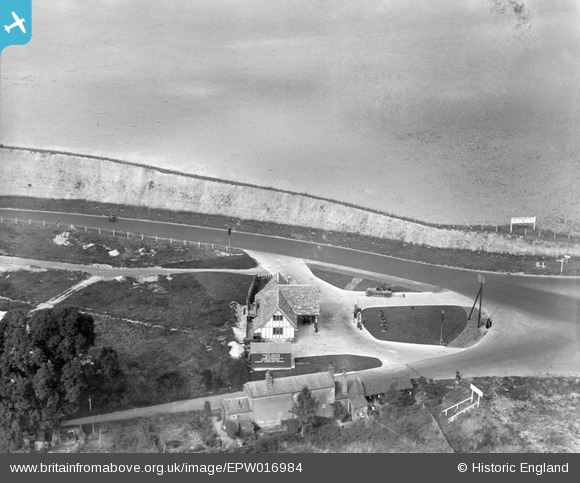
EPW016984 ENGLAND (1926). The newly-built bypass (A20) and petrol station, Farningham, 1926
© Copyright OpenStreetMap contributors and licensed by the OpenStreetMap Foundation. 2026. Cartography is licensed as CC BY-SA.
Nearby Images (15)
EPW016984
 and petrol station, Farningham, 1926")
EPW016987
 and petrol station, Farningham, 1926")
EPW016852

EPW016985

EPW016848

EPW016849

EPW016846

EPW016845

EPW016844

EPW016986
 and petrol station, Farningham, 1926")
EPW016851

EPW016847

EPW016853

EPW016983
 and petrol station, Farningham, 1926")
EPW016850

Details
| Title | [EPW016984] The newly-built bypass (A20) and petrol station, Farningham, 1926 |
| Reference | EPW016984 |
| Date | October-1926 |
| Link | |
| Place name | FARNINGHAM |
| Parish | FARNINGHAM |
| District | |
| Country | ENGLAND |
| Easting / Northing | 554661, 167280 |
| Longitude / Latitude | 0.22278432809856, 51.382969750132 |
| National Grid Reference | TQ547673 |
Pins
Be the first to add a comment to this image!