
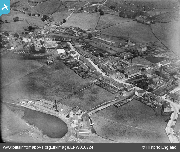
EPW016724 ENGLAND (1926). Ramsden Road, Wardle, 1926
© Copyright OpenStreetMap contributors and licensed by the OpenStreetMap Foundation. 2026. Cartography is licensed as CC BY-SA.
Nearby Images (2)
EPW016724

EPW016723

Details
| Title | [EPW016724] Ramsden Road, Wardle, 1926 |
| Reference | EPW016724 |
| Date | 29-August-1926 |
| Link | |
| Place name | WARDLE |
| Parish | |
| District | |
| Country | ENGLAND |
| Easting / Northing | 391265, 416853 |
| Longitude / Latitude | -2.1321580911526, 53.647876602232 |
| National Grid Reference | SD913169 |
Pins

SNoon |
Sunday 1st of March 2020 07:04:39 PM |