
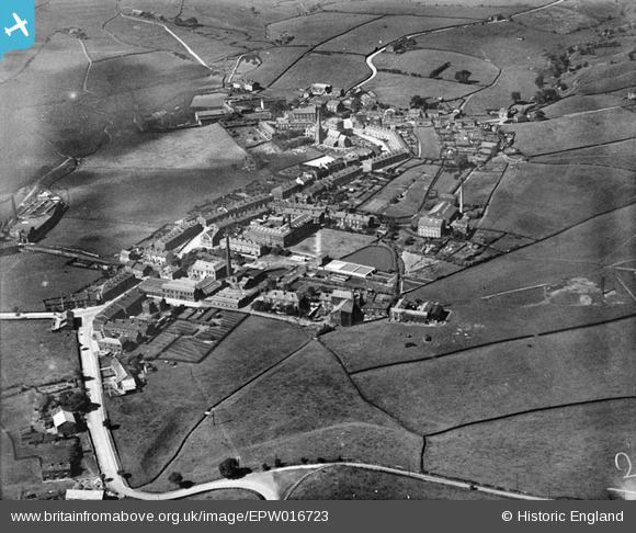
EPW016723 ENGLAND (1926). The village, Wardle, 1926
© Copyright OpenStreetMap contributors and licensed by the OpenStreetMap Foundation. 2026. Cartography is licensed as CC BY-SA.
Nearby Images (2)
EPW016723

EPW016724

Details
| Title | [EPW016723] The village, Wardle, 1926 |
| Reference | EPW016723 |
| Date | 29-August-1926 |
| Link | |
| Place name | WARDLE |
| Parish | |
| District | |
| Country | ENGLAND |
| Easting / Northing | 391385, 416821 |
| Longitude / Latitude | -2.1303416430882, 53.647590937485 |
| National Grid Reference | SD914168 |
Pins

John Nuttall |
Thursday 2nd of April 2026 11:20:33 AM | |
|
John Nuttall |
Thursday 2nd of April 2026 11:13:56 AM |