
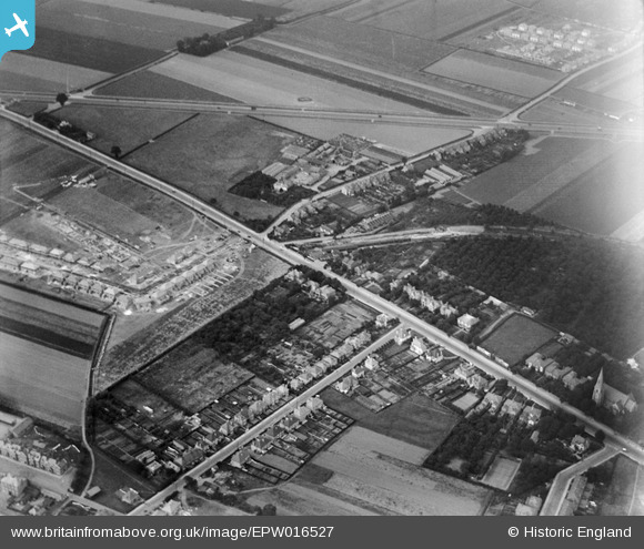
EPW016527 ENGLAND (1926). Bath Road, Hounslow, 1926
© Copyright OpenStreetMap contributors and licensed by the OpenStreetMap Foundation. 2026. Cartography is licensed as CC BY-SA.
Nearby Images (18)
EPW016527

EPW016529

EPW016528

EPW037519

EPW037517

EPW037334

EPW037518

EPW037296

EPW033774

EPW037332

EPW035079

EPW035093

EPW017168

EPW037294

EPW017162

EPW033773

EPW033772

EPW035032

Details
| Title | [EPW016527] Bath Road, Hounslow, 1926 |
| Reference | EPW016527 |
| Date | August-1926 |
| Link | |
| Place name | HOUNSLOW |
| Parish | |
| District | |
| Country | ENGLAND |
| Easting / Northing | 512240, 176131 |
| Longitude / Latitude | -0.38377488822983, 51.472508938408 |
| National Grid Reference | TQ122761 |
Pins

plebbus |
Sunday 17th of May 2020 01:24:02 AM | |

Des Elmes |
Thursday 14th of April 2016 09:01:05 PM | |
|
Des Elmes |
Thursday 14th of April 2016 08:59:07 PM | |
|
Des Elmes |
Thursday 14th of April 2016 08:58:10 PM | |
|
glennsalt@gmail.com |
Tuesday 1st of March 2016 02:02:56 PM | |
|
glennsalt@gmail.com |
Monday 29th of February 2016 07:51:47 AM | |
|
glennsalt@gmail.com |
Monday 29th of February 2016 07:50:07 AM | |

Class31 |
Thursday 23rd of July 2015 06:58:58 PM |
