
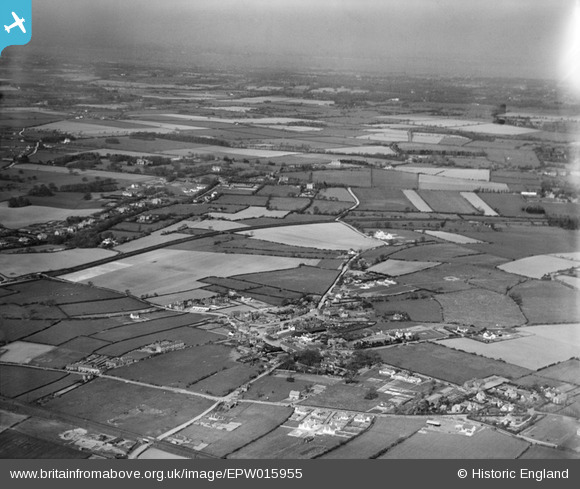
EPW015955 ENGLAND (1926). The village and environs, Little Neston, from the south, 1926
© Copyright OpenStreetMap contributors and licensed by the OpenStreetMap Foundation. 2026. Cartography is licensed as CC BY-SA.
Nearby Images (2)
EPW015955

 0°
0m
0°
0m
EPW015953
 216°
77m
216°
77m
Details
| Title | [EPW015955] The village and environs, Little Neston, from the south, 1926 |
| Reference | EPW015955 |
| Date | June-1926 |
| Link | |
| Place name | LITTLE NESTON |
| Parish | NESTON |
| District | |
| Country | ENGLAND |
| Easting / Northing | 330000, 376900 |
| Longitude / Latitude | -3.0500825106186, 53.284168896096 |
| National Grid Reference | SJ300769 |
Pins
 Hinderton Hall Hinderton Hall |

Annabel |
Wednesday 18th of February 2026 12:59:21 PM |
| Lees Lane Ponds |
RPerry |
Tuesday 1st of December 2015 03:14:03 PM |
| Upper Raby Road. |
Bunn72 |
Thursday 23rd of January 2014 01:03:04 PM |
| Hinderton Road. |
Bunn72 |
Thursday 23rd of January 2014 01:01:41 PM |
| Burton Road. |
Bunn72 |
Thursday 23rd of January 2014 01:00:42 PM |
| Bull Hill. |
Bunn72 |
Thursday 23rd of January 2014 01:00:16 PM |
| Lees Lane. |
Bunn72 |
Thursday 23rd of January 2014 12:59:08 PM |
| The Green, Little Neston. |
Bunn72 |
Thursday 23rd of January 2014 12:58:37 PM |
| Borderlands Line (remains open). |
Bunn72 |
Thursday 23rd of January 2014 12:58:11 PM |
| Mellock Lane. |
Bunn72 |
Thursday 23rd of January 2014 12:56:02 PM |
| Hooton-West Kirby branch line (closed 1962). |
Bunn72 |
Thursday 23rd of January 2014 12:55:35 PM |