
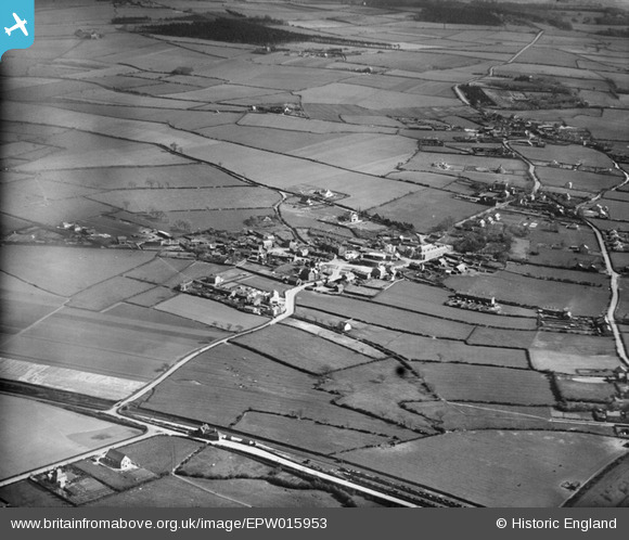
EPW015953 ENGLAND (1926). The village and environs, Little Neston, 1926
© Copyright OpenStreetMap contributors and licensed by the OpenStreetMap Foundation. 2026. Cartography is licensed as CC BY-SA.
Nearby Images (2)
EPW015953

 0°
0m
0°
0m
EPW015955
 36°
77m
36°
77m
Details
| Title | [EPW015953] The village and environs, Little Neston, 1926 |
| Reference | EPW015953 |
| Date | June-1926 |
| Link | |
| Place name | LITTLE NESTON |
| Parish | NESTON |
| District | |
| Country | ENGLAND |
| Easting / Northing | 329955, 376837 |
| Longitude / Latitude | -3.0507435471458, 53.283596689921 |
| National Grid Reference | SJ300768 |
Pins
 The Hill, now the site of Hill Court, off Mill Lane The Hill, now the site of Hill Court, off Mill Lane |

Saul Marks |
Thursday 24th of September 2026 12:15:30 PM |
| Haddon Wood. |
Bunn72 |
Thursday 23rd of January 2014 12:53:46 PM |
| The Green, Little Neston. |
Bunn72 |
Thursday 23rd of January 2014 12:53:15 PM |
| Burton Road. |
Bunn72 |
Thursday 23rd of January 2014 12:52:30 PM |
| Present site of Ness Botanic Gardens. |
Bunn72 |
Thursday 23rd of January 2014 12:51:06 PM |
| Neston Road. |
Bunn72 |
Thursday 23rd of January 2014 12:50:07 PM |
| Ness. |
Bunn72 |
Thursday 23rd of January 2014 12:49:38 PM |
| Hooton to West Kirby branch line (closed 1962). Parts of the trackbed is now used as the Wirral Way. |
Bunn72 |
Thursday 23rd of January 2014 12:49:08 PM |
| Bushell Road. |
Bunn72 |
Thursday 23rd of January 2014 12:47:05 PM |
| Mellock Lane |
Bunn72 |
Thursday 23rd of January 2014 12:44:45 PM |
| Neston South railway station. |
Bunn72 |
Thursday 23rd of January 2014 12:43:30 PM |