
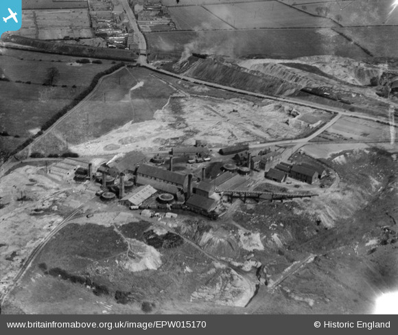
EPW015170 ENGLAND (1926). Brick and Tile Works at Colliery Farm, Coalville, 1926
© Copyright OpenStreetMap contributors and licensed by the OpenStreetMap Foundation. 2025. Cartography is licensed as CC BY-SA.
Nearby Images (2)
EPW015170

EPW015168

Details
| Title | [EPW015170] Brick and Tile Works at Colliery Farm, Coalville, 1926 |
| Reference | EPW015170 |
| Date | 13-April-1926 |
| Link | |
| Place name | COALVILLE |
| Parish | |
| District | |
| Country | ENGLAND |
| Easting / Northing | 442688, 314829 |
| Longitude / Latitude | -1.3677990871138, 52.729075786484 |
| National Grid Reference | SK427148 |
Pins
 rd84 |
Wednesday 25th of December 2013 06:00:51 PM |
User Comment Contributions
You can see the slag heap belonging to Whitwick Colliery in the background along with the Charnwood Forest Railway which ran to Loughborough, Derby Road station. |
rd84 |
Friday 25th of May 2012 07:22:50 PM |