
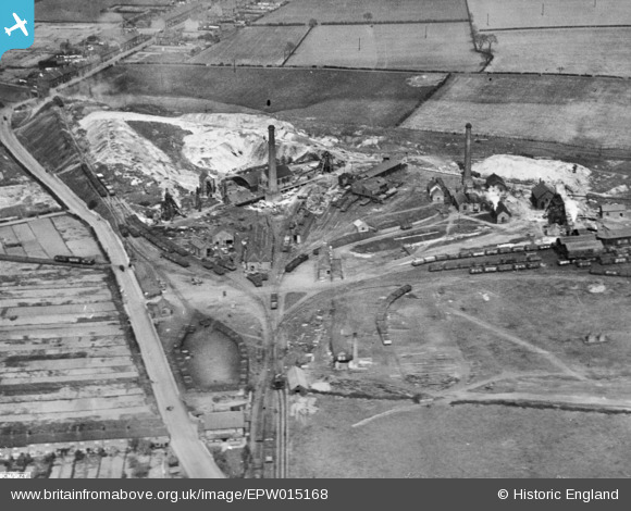
EPW015168 ENGLAND (1926). Whitwick Colliery, Coalville, 1926. This image has been produced from a copy-negative.
© Copyright OpenStreetMap contributors and licensed by the OpenStreetMap Foundation. 2025. Cartography is licensed as CC BY-SA.
Nearby Images (2)
EPW015168

EPW015170

Details
| Title | [EPW015168] Whitwick Colliery, Coalville, 1926. This image has been produced from a copy-negative. |
| Reference | EPW015168 |
| Date | 13-April-1926 |
| Link | |
| Place name | COALVILLE |
| Parish | |
| District | |
| Country | ENGLAND |
| Easting / Northing | 442919, 314679 |
| Longitude / Latitude | -1.364397861289, 52.727708990185 |
| National Grid Reference | SK429147 |
Pins
 Timboishere |
Friday 28th of November 2014 08:26:52 PM | |
Tsauru |
Monday 10th of November 2014 02:51:05 PM | |
rd84 |
Saturday 1st of November 2014 07:18:21 PM |