
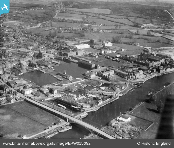
EPW015082 ENGLAND (1926). Canal basins adjacent to Bridge Street, Stourport-on-Severn, 1926
© Copyright OpenStreetMap contributors and licensed by the OpenStreetMap Foundation. 2026. Cartography is licensed as CC BY-SA.
Nearby Images (8)
EPW015082

EPW015079

EPW061729

EPW015076

EPW061730

EPW061731

EPW041758

EPW061728

Details
| Title | [EPW015082] Canal basins adjacent to Bridge Street, Stourport-on-Severn, 1926 |
| Reference | EPW015082 |
| Date | 12-April-1926 |
| Link | |
| Place name | STOURPORT-ON-SEVERN |
| Parish | STOURPORT-ON-SEVERN |
| District | |
| Country | ENGLAND |
| Easting / Northing | 381082, 271087 |
| Longitude / Latitude | -2.2776873095897, 52.337153430819 |
| National Grid Reference | SO811711 |
