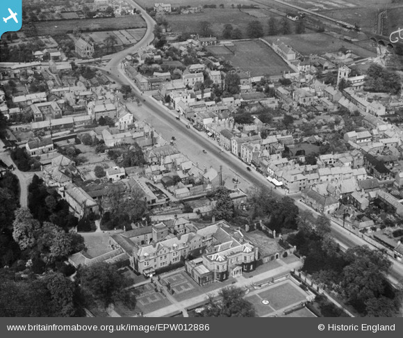
EPW012886 ENGLAND (1925). The High Street, Bawtry, 1925
© Copyright OpenStreetMap contributors and licensed by the OpenStreetMap Foundation. 2025. Cartography is licensed as CC BY-SA.
Details
| Title | [EPW012886] The High Street, Bawtry, 1925 |
| Reference | EPW012886 |
| Date | May-1925 |
| Link | |
| Place name | BAWTRY |
| Parish | BAWTRY |
| District | |
| Country | ENGLAND |
| Easting / Northing | 465126, 392956 |
| Longitude / Latitude | -1.0197148326622, 53.42910737245 |
| National Grid Reference | SK651930 |
Pins

John Wass |
Tuesday 16th of December 2014 02:40:42 PM |


![[EPW012886] The High Street, Bawtry, 1925](http://britainfromabove.org.uk/sites/all/libraries/aerofilms-images/public/100x100/EPW/012/EPW012886.jpg)
![[EPW054544] Bawtry Hall, the High Street and the town, Bawtry, 1937](http://britainfromabove.org.uk/sites/all/libraries/aerofilms-images/public/100x100/EPW/054/EPW054544.jpg)
![[EPW012883] The village centre, Bawtry, 1925](http://britainfromabove.org.uk/sites/all/libraries/aerofilms-images/public/100x100/EPW/012/EPW012883.jpg)
![[EPW012885] The High Street, Bawtry, 1925](http://britainfromabove.org.uk/sites/all/libraries/aerofilms-images/public/100x100/EPW/012/EPW012885.jpg)