
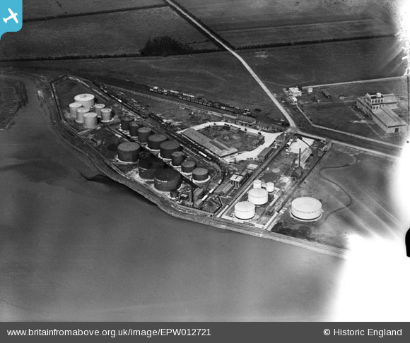
EPW012721 ENGLAND (1925). Salt End Distillery, Salt End, 1925
© Copyright OpenStreetMap contributors and licensed by the OpenStreetMap Foundation. 2026. Cartography is licensed as CC BY-SA.
Nearby Images (12)
EPW012721

EPW012714

EPW012717

EPW009394

EPW012715

EPW012716

EPW006331

EPW012713

EAW015666

EAW015643

EPW034671

EPW036411

Details
| Title | [EPW012721] Salt End Distillery, Salt End, 1925 |
| Reference | EPW012721 |
| Date | 6-May-1925 |
| Link | |
| Place name | SALT END |
| Parish | PRESTON |
| District | |
| Country | ENGLAND |
| Easting / Northing | 515959, 428006 |
| Longitude / Latitude | -0.24185209045739, 53.73530910173 |
| National Grid Reference | TA160280 |
Pins
Be the first to add a comment to this image!