
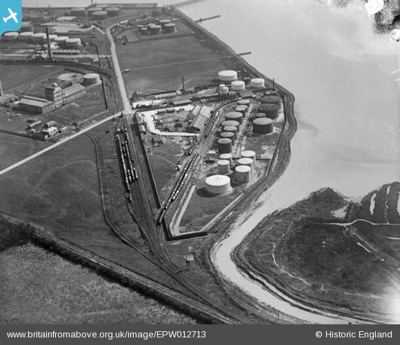
EPW012713 ENGLAND (1925). Salt End Distillery, Salt End, 1925
© Copyright OpenStreetMap contributors and licensed by the OpenStreetMap Foundation. 2026. Cartography is licensed as CC BY-SA.
Nearby Images (12)
EPW012713

EPW012715

EPW012714

EPW012721

EPW012717

EPW009394

EPW012716

EAW015666

EAW015642

EPW034637

EPW046762

EAW015643

Details
| Title | [EPW012713] Salt End Distillery, Salt End, 1925 |
| Reference | EPW012713 |
| Date | 6-May-1925 |
| Link | |
| Place name | SALT END |
| Parish | PRESTON |
| District | |
| Country | ENGLAND |
| Easting / Northing | 516000, 428146 |
| Longitude / Latitude | -0.24117825125077, 53.736557864515 |
| National Grid Reference | TA160281 |
Pins
Be the first to add a comment to this image!