
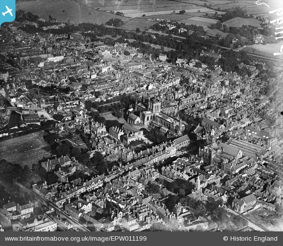
EPW011199 ENGLAND (1924). The Cathedral and city centre, Chester, 1924
© Copyright OpenStreetMap contributors and licensed by the OpenStreetMap Foundation. 2026. Cartography is licensed as CC BY-SA.
Nearby Images (23)
EPW011199

EPW029880

EPW005885

EPW004003

EPW040162

EPW004008

EPW004007

EPW029886

EPW004006

EAW004377

EPW058007

EPW029883

EPW058010

EPW029885

EPW058002

EPW011200

EPW003097

EPW029881

EPW029884

EPW003090

EPW040167

EPW037240

EPW058009

Details
| Title | [EPW011199] The Cathedral and city centre, Chester, 1924 |
| Reference | EPW011199 |
| Date | July-1924 |
| Link | |
| Place name | CHESTER |
| Parish | |
| District | |
| Country | ENGLAND |
| Easting / Northing | 340557, 366500 |
| Longitude / Latitude | -2.8897969632858, 53.191974819607 |
| National Grid Reference | SJ406665 |
Pins

Ange |
Thursday 30th of May 2013 11:34:00 PM |