
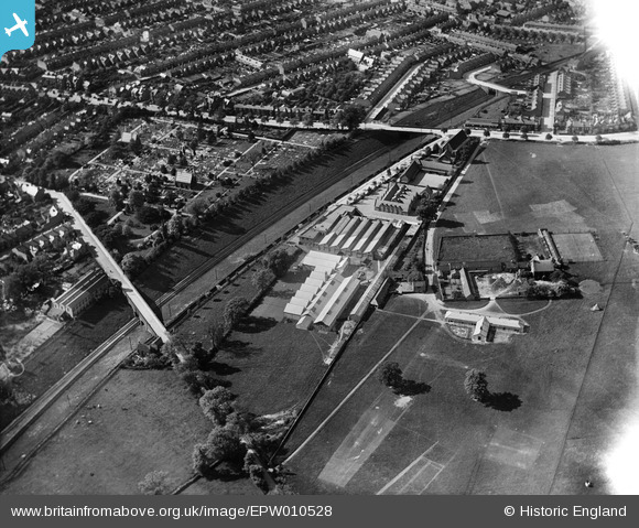
EPW010528 ENGLAND (1924). The Cemetery, Technical School and Clifton Road area, Rugby, 1924
© Copyright OpenStreetMap contributors and licensed by the OpenStreetMap Foundation. 2025. Cartography is licensed as CC BY-SA.
Nearby Images (2)
EPW010528

EPW028850

Details
| Title | [EPW010528] The Cemetery, Technical School and Clifton Road area, Rugby, 1924 |
| Reference | EPW010528 |
| Date | 28-May-1924 |
| Link | |
| Place name | RUGBY |
| Parish | |
| District | |
| Country | ENGLAND |
| Easting / Northing | 451439, 275009 |
| Longitude / Latitude | -1.2443838063574, 52.370327863148 |
| National Grid Reference | SP514750 |
Pins

John Duffield |
Saturday 22nd of February 2014 12:39:11 PM | |
|
John Duffield |
Saturday 22nd of February 2014 12:38:06 PM | |
|
John Duffield |
Saturday 22nd of February 2014 12:31:41 PM | |
|
John Duffield |
Saturday 22nd of February 2014 12:30:18 PM | |
|
Phil Hancock |
Monday 6th of January 2014 09:18:41 AM | |
|
Ian Robinson |
Saturday 8th of June 2013 08:03:19 PM | |
|
Ian Robinson |
Saturday 8th of June 2013 08:01:30 PM | |
|
Ian Robinson |
Saturday 8th of June 2013 08:00:30 PM |