
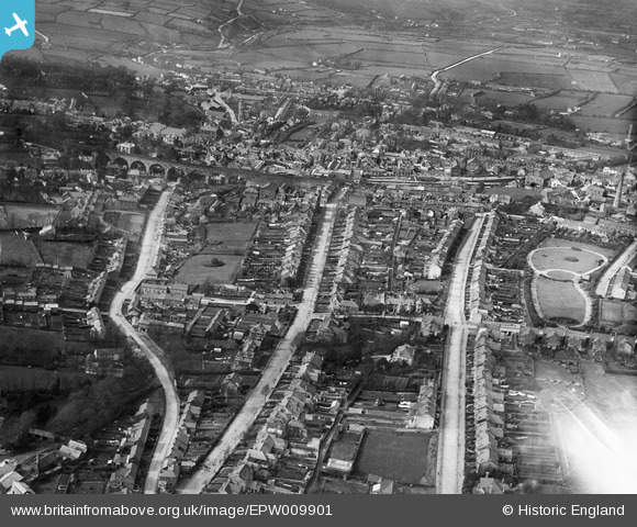
EPW009901 ENGLAND (1924). Clinton Road and environs, Redruth, 1924
© Copyright OpenStreetMap contributors and licensed by the OpenStreetMap Foundation. 2026. Cartography is licensed as CC BY-SA.
Nearby Images (10)
EPW009901

EPW039788

EAW033648

EAW033649

EPW039787

EPW009902

EPW039790

EPW009904

EPW021734

EPW009905

Details
| Title | [EPW009901] Clinton Road and environs, Redruth, 1924 |
| Reference | EPW009901 |
| Date | March-1924 |
| Link | |
| Place name | REDRUTH |
| Parish | REDRUTH |
| District | |
| Country | ENGLAND |
| Easting / Northing | 170089, 41720 |
| Longitude / Latitude | -5.2240687217846, 50.230085498032 |
| National Grid Reference | SW701417 |
Pins

Pentaprism |
Monday 9th of November 2020 11:47:06 PM | |
|
Pentaprism |
Monday 9th of November 2020 11:46:02 PM | |
|
Pentaprism |
Monday 9th of November 2020 11:44:57 PM | |
|
MikeB |
Thursday 6th of June 2013 10:22:26 PM | |
|
Stu |
Friday 3rd of May 2013 08:45:10 PM | |
|
pablopz |
Friday 3rd of May 2013 01:21:35 PM | |
|
pablopz |
Friday 3rd of May 2013 01:21:06 PM | |
|
pablopz |
Friday 3rd of May 2013 01:20:33 PM | |
|
pablopz |
Friday 3rd of May 2013 01:20:04 PM |
User Comment Contributions

Falmouth Road looking south, Redruth, 15/04/2015 |

Class31 |
Thursday 15th of December 2016 11:57:06 AM |