
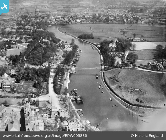
EPW005886 ENGLAND (1921). Queen's Park Suspension Bridge and the River Dee, Chester, 1921. This image has been produced from a copy-negative.
© Copyright OpenStreetMap contributors and licensed by the OpenStreetMap Foundation. 2026. Cartography is licensed as CC BY-SA.
Nearby Images (10)
EPW005886

EPW003095

EPW005887

EPW004010

EPW040163

EPW005882

EPW040165

EPW004004

EPW029589

EPW003098

Details
| Title | [EPW005886] Queen's Park Suspension Bridge and the River Dee, Chester, 1921. This image has been produced from a copy-negative. |
| Reference | EPW005886 |
| Date | March-1921 |
| Link | |
| Place name | CHESTER |
| Parish | |
| District | |
| Country | ENGLAND |
| Easting / Northing | 341026, 366019 |
| Longitude / Latitude | -2.8826886567687, 53.18770339308 |
| National Grid Reference | SJ410660 |
Pins
Be the first to add a comment to this image!