
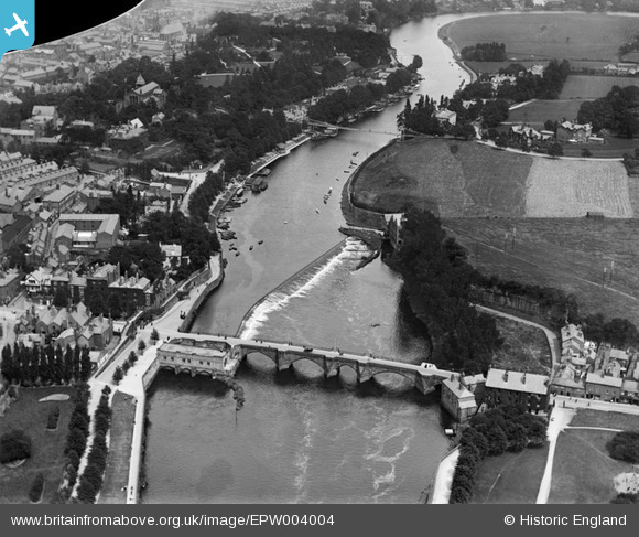
EPW004004 ENGLAND (1920). The Dee Bridge, Chester, 1920
© Copyright OpenStreetMap contributors and licensed by the OpenStreetMap Foundation. 2026. Cartography is licensed as CC BY-SA.
Nearby Images (11)
EPW004004

EPW003098

EPW058012

EPW040163

EPW004002

EPW058003

EPW003095

EPW003088

EPW029590

EPW005886

EPW036909

Details
| Title | [EPW004004] The Dee Bridge, Chester, 1920 |
| Reference | EPW004004 |
| Date | July-1920 |
| Link | |
| Place name | CHESTER |
| Parish | |
| District | |
| Country | ENGLAND |
| Easting / Northing | 340806, 365855 |
| Longitude / Latitude | -2.8859506735596, 53.186204781826 |
| National Grid Reference | SJ408659 |
Pins

locater55 |
Monday 28th of July 2014 08:53:51 PM | |
|
MB |
Saturday 22nd of September 2012 06:06:34 PM | |
|
MB |
Saturday 22nd of September 2012 06:05:09 PM | |
|
MB |
Saturday 22nd of September 2012 06:02:41 PM |

