
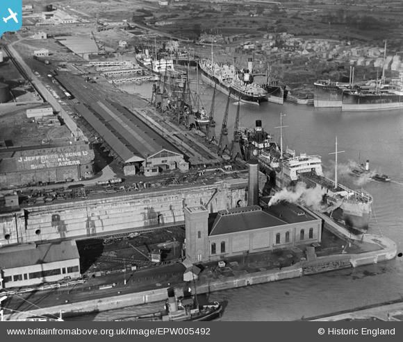
EPW005492 ENGLAND (1921). The Graving Dock, Pumping Station and Royal Edward Dock, Avonmouth, 1921
© Copyright OpenStreetMap contributors and licensed by the OpenStreetMap Foundation. 2026. Cartography is licensed as CC BY-SA.
Nearby Images (19)
EPW005492

EPW005508

EAW002058

EPW005502

EPW005493

EAW002255

EPR000059A

EPW005500

EPR000075

EAW002062

EPW027952

EPW022378

EPW037152

EAW002056

EPW005491

EAW002060

EAW002070

EAW002059

EPW022377

Details
| Title | [EPW005492] The Graving Dock, Pumping Station and Royal Edward Dock, Avonmouth, 1921 |
| Reference | EPW005492 |
| Date | 20-March-1921 |
| Link | |
| Place name | AVONMOUTH |
| Parish | |
| District | |
| Country | ENGLAND |
| Easting / Northing | 350866, 178792 |
| Longitude / Latitude | -2.708009038807, 51.505439407201 |
| National Grid Reference | ST509788 |

