
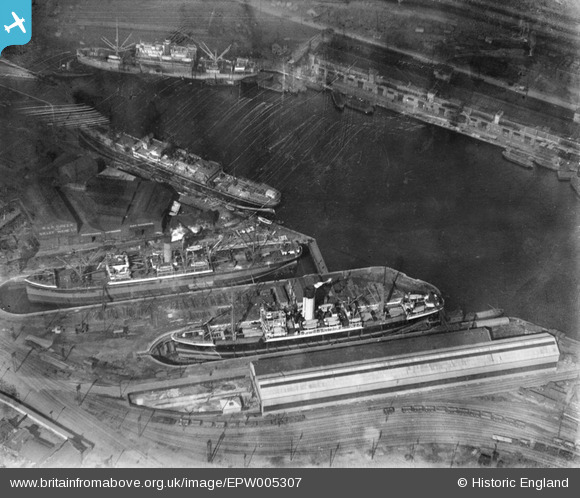
EPW005307 ENGLAND (1921). Royal Albert Dock, Custom House, 1921
© Copyright OpenStreetMap contributors and licensed by the OpenStreetMap Foundation. 2026. Cartography is licensed as CC BY-SA.
Nearby Images (7)
EPW005307

EPW046151

EPW044118

EPW032946

EPW032927

EPW046152

EAW022356

Details
| Title | [EPW005307] Royal Albert Dock, Custom House, 1921 |
| Reference | EPW005307 |
| Date | January-1921 |
| Link | |
| Place name | CUSTOM HOUSE |
| Parish | |
| District | |
| Country | ENGLAND |
| Easting / Northing | 541934, 180563 |
| Longitude / Latitude | 0.045330589985005, 51.505668207539 |
| National Grid Reference | TQ419806 |
Pins
Be the first to add a comment to this image!