
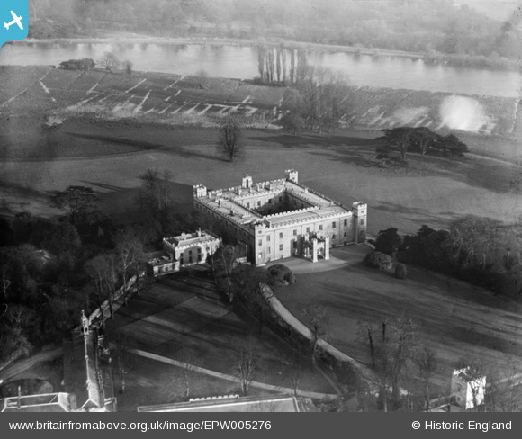
EPW005276 ENGLAND (1921). Syon House, Brentford, 1921
© Copyright OpenStreetMap contributors and licensed by the OpenStreetMap Foundation. 2026. Cartography is licensed as CC BY-SA.
Nearby Images (7)
EPW005276

EPW005274

EPW005275

EAW008236A

EPW005273

EAW008238

EAW008237

Details
| Title | [EPW005276] Syon House, Brentford, 1921 |
| Reference | EPW005276 |
| Date | January-1921 |
| Link | |
| Place name | BRENTFORD |
| Parish | |
| District | |
| Country | ENGLAND |
| Easting / Northing | 517302, 176669 |
| Longitude / Latitude | -0.31073815143634, 51.47631780214 |
| National Grid Reference | TQ173767 |
Pins
Be the first to add a comment to this image!