
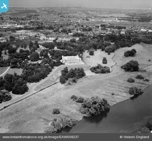
EAW008237 ENGLAND (1947). Syon House, Brentford, from the south, 1947
© Copyright OpenStreetMap contributors and licensed by the OpenStreetMap Foundation. 2026. Cartography is licensed as CC BY-SA.
Nearby Images (6)
EAW008237

EPW005274

EPW005275

EPW005276

EAW008236A

EAW008238

Details
| Title | [EAW008237] Syon House, Brentford, from the south, 1947 |
| Reference | EAW008237 |
| Date | 16-July-1947 |
| Link | |
| Place name | BRENTFORD |
| Parish | |
| District | |
| Country | ENGLAND |
| Easting / Northing | 517255, 176460 |
| Longitude / Latitude | -0.31148406144185, 51.474448922753 |
| National Grid Reference | TQ173765 |
