
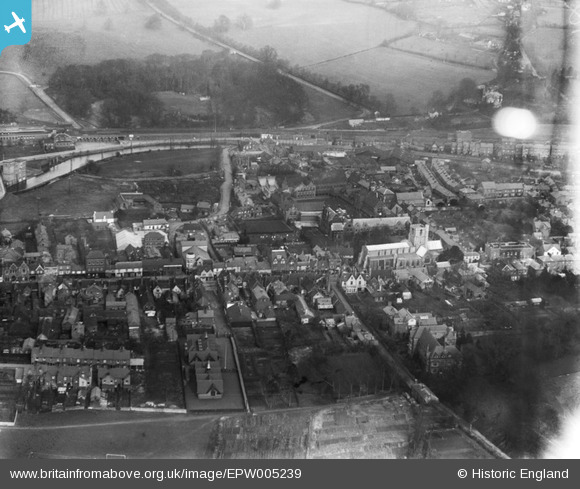
EPW005239 ENGLAND (1921). Mill Street and St Peter's Church area, Berkhamsted, 1921
© Copyright OpenStreetMap contributors and licensed by the OpenStreetMap Foundation. 2026. Cartography is licensed as CC BY-SA.
Nearby Images (11)
EPW005239

EPW056456

EPW005037

EPW005035

EPW005032

EPW056455

EAW041753

EPW056457

EPW022501

EPW021329

EPW056459

Details
| Title | [EPW005239] Mill Street and St Peter's Church area, Berkhamsted, 1921 |
| Reference | EPW005239 |
| Date | January-1921 |
| Link | |
| Place name | BERKHAMSTED |
| Parish | BERKHAMSTED |
| District | |
| Country | ENGLAND |
| Easting / Northing | 499349, 207848 |
| Longitude / Latitude | -0.56034053003813, 51.760040071545 |
| National Grid Reference | SP993078 |
Pins

John Wass |
Wednesday 9th of November 2016 02:47:44 PM |
User Comment Contributions
I got Married in this Church on American independance day! Irony i guess. 2012 Berko is much changed since 1921 i hasten to add. |
rtfacts |
Wednesday 15th of August 2012 10:39:11 AM |